Ongoing Project
BAY TERMINAL, CHITTAGONG PORT AUTHORITY , Contracted Detailed Engineering Design of Breakwater for Bay Terminal and Assess the Actual Volume of Capital Dredging Including Necessary Studies of Access Channel.
- Zone-1 :Single Beam Bathymetry: Approx.53 40 sqkm. in water depth from about 2 to 13 m Chart Datum.
- Zone-2 :Single Beam Bathymetry: Line spacing to be 200m. Approx.200 / 170 sqkm in water depth from about 7 to 15 m Chart Datum.
- Zone-3 :Single Beam Bathymetry: Single Beam Bathymetry 50 km single beam line survey in water depth from 6 to 12 m Chart Datum. Sub-bottom profile along the navigation channel.
- Sub-Soil Investigation -OFFSHORE: Rotary Core Boreholes to 50m below seabed. SPT and core samples to be taken . 15 Marine Boreholes in water depth between 0 to 10m Chart Datum.
- Vibracore-OFFSHORE: Vibracore drilling along the navigation channel line to be determined. The holes are required to reach a depth of -13m CD into the seabed. These works are to be commissioned on completion of the proposed route for the navigation channel during the design. These will inform the dredging contract. 25 vibracores at each 2000m chainage in water depth from 6 to 12 m Chart Datum. 25 vibracores (locations to be confirmed along navigation channel) in water depth from 6 to 13m Chart Datum.
- Acoustic Doppler current profiler (ADCP)-OFFSHORE: An Acoustic Doppler Current Profiler (ADCP) should be deployed near-bed in the vicinity of the breakwater (seaward side) and in the vicinity of the terminal. 2 ADCP in water depth from 5 to 12m Chart Datum. Measurements to be taken for 70sec intervals every hour for 6 weeks. The instrument should deliver, every ½ hour. Wave data. Current speed and direction. Water-level.
- OBS (Optical back scattered)-OFFSHORE: 4 OBS instruments at two location in water depth from 5 to 12m Chart Datum. Two OBS to be deployed, one at mid-depth and one at 1m above sea-bed. Deployment of 4 Optical Backscatter Sensors, OBS. optical backscatter point sensor (OBS) ) at two location at to positions. Measurements to be taken for 6 3 weeks. After which data is recovered and OBS is cleand of marine fouling and redeployed for another 3 weeks. OBS setting to ensure measurements are obtained without instrument saturation (from high turbidity while avoiding excessively low signal response).
- Sand Trap-OFFSHOREs: 4 Sand traps in water depth from 5 to 12 m Chart Datum. These should be at the same elevation as the OBS (one at mid-depth, and one at 1m above sea-bed, at each of the 2 locations). Deployment of 4 sand traps for collection of settling suspended sediment . Sand traps to be in position for 6 / 3 weeks. Accumulated material washed out and bagged after 3 week Deployment for a further 3 weeks, after which sediment is again recovered. Weight and grain size distribution to be analysed).
- Grab samples-OFFSHORE: 50/ 40 samples in water depth from 5 to 12m Chart Datum. At each of the 6 water sampling stations, at the two OBS (and sand trap and water sampling) stations. Repeat after 6 weeks. Total 16 smples. In addition sample at regular intervals (once of) along the navigation channel- Total 34 samples) . Area of grab samples to be confirmed at appointment. Samples are to be analysed by means of sieving in accordance with to determine detailed grain size distributions. Sieving to be conducted according to British/European/American standards. The percentage of fine material (less than 63 microns) is required for each sample, as well as the organic content (percentage/mass)
- Water samples-OFFSHORE: 8 water column profiling sampling exercises in water depth from 5 to 12m Chart Datum
- CPT (Cone penetration testing)-OFFSHORE: 10 Cone Penitration Test (CPTu) in water depth between upto to 3m Chard Datum. 15 Marine CPT Boreholes in water depth starting between 0m to 10m chart Datum.
Completed Project
Sub Soil Investigations on Offshore for GRC, Matharbari, CoxsBazar, Chittagong, Bangladesh
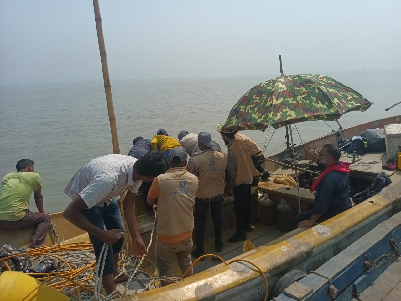
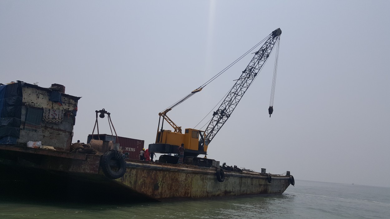
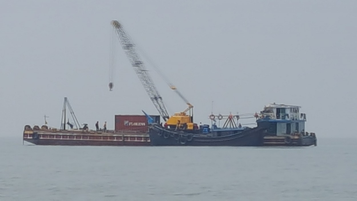
Completed 15 Geotechnical / Sub Soil Investigations on Offshore for Reliance POWER LNG- Matharbari, CoxsBazar, Chittagong, Bangladesh. 50 mt, 80 mt, 100 mt, 120 mt After Seabed. Water depth 17 mt.
Sub Soil Investigations on Offshore for Reliance POWER LNG- Matharbari, CoxsBazar, Chittagong, Bangladesh
Completed 15 Geotechnical / Sub Soil Investigations on Offshore for Reliance POWER LNG- Matharbari, CoxsBazar, Chittagong, Bangladesh. 50 mt, 80 mt, 100 mt, 120 mt After Seabed. Water depth 17 mt.
LNG PROJECT GEOTECHNICAL INVESTIGATION Soil TEST works ON ONSHORE
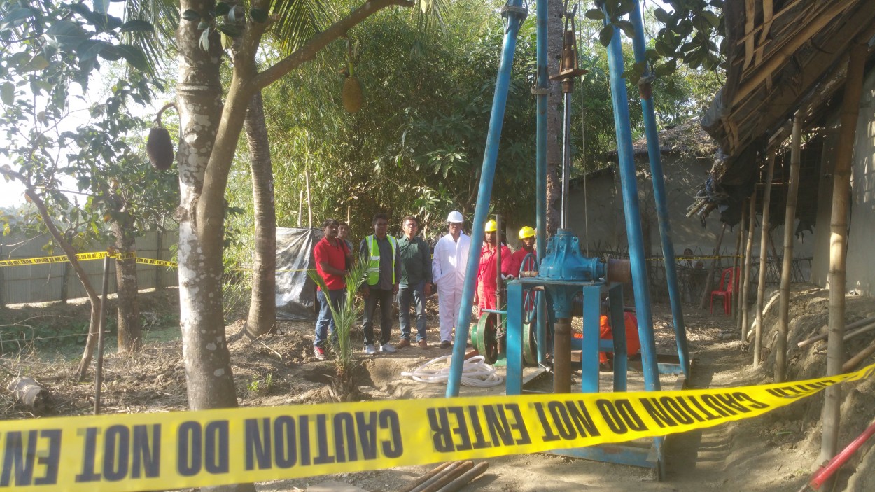
GEOTECHNICAL INVESTIGATION Soil TEST,works BY AB GEOTECH MARITIME LIMITED successfully completed for Reliance POWER LNG WITH Geo service maritime ltd, LNG Project ON ONSHORE AT Kutubdia, coxsbazar, Chittagong.

LNG PROJECTS GEOTECHNICAL INVESTIGATION SOIL TEST WORKS ON ONSHORE
GEOTECHNICAL INVESTIGATION BY AB GEOTECH MARITIME LIMITED successfully completed boreholes Soil TEST PETRONET LNG LIMITED WITH Sharathi geotech for LNG Project ON ONSHORE AT Kutubdia, coxsbazar, Chittagong.

GEOTECHNICAL INVESTIGATION SOIL TEST WORKS LNG Project BY AB GEOTECH MARITIME LIMITED ON OFFSHORE
GEOTECHNICAL INVESTIGATION SOIL TEST WORKS BY AB GEOTECH MARITIME LIMITED DOING PETRONET LNG LIMITED WITH Sharathi geotech for LNG Project ON OFFSHORE AT Kutubdia, coxsbazar, Chittagong.